 |
||||||||||||||||||||||||||||||||||
Volume1, Number 10, July, 2011 |
||||||||||||||||||||||||||||||||||
for more info go to:
|
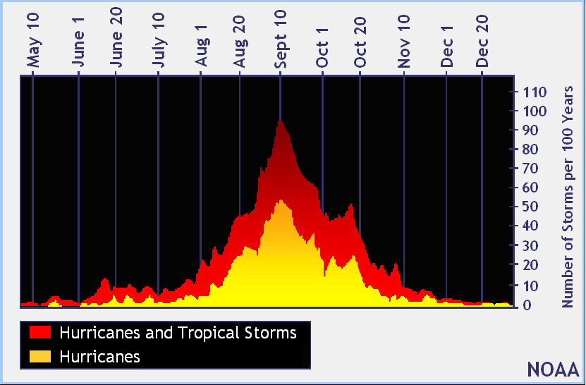
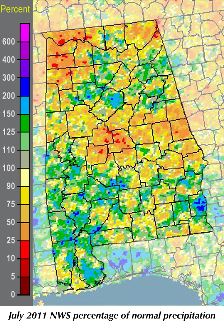
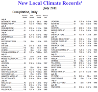
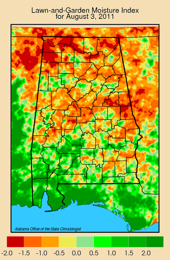
The dog days of August bring to Alabama not only uncomfortable heat but also the return of hurricane season. While data from the National Weather Service's National Hurricane Center (NHC) shows that hurricanes and tropical storms do (rarely) pop up as early as the first of May to as late as Christmas, the annual build-up starts just before Aug. 1 and peaks on Sept. 10. The NHC graph of storms (left) shows that most years there will be at least one hurricane or tropical storm present at the peak. At the moment we are watching tropical storm Emily (http://www.nhc.noaa.gov/) rumble around in the Western Atlantic, posing some threat to shipping and people along the coast from Florida to Virginia. We remember hurricane Katrina and many of us remember hurricane Ivan, but how often is our gulf coast likely to be hit by a hurricane? The NHC looks at that in terms of "return periods," specifically, on average how many years there are between hurricanes of different strengths hitting within 75 nautical miles (86 statute miles) of different spots along the coast. According to that data, Mobile and Gulf Shores/Orange Beach can expect a category one hurricane (such as hurricane Danny) slightly more than once every decade, and a category two (like hurricane Georges) every 17 to 21 years. Fortunately, more powerful hurricanes are also less common. On average, a category three hurricane (such as hurricanes Frederic and Ivan) would be expected to come ashore in Alabama every 28 years in Gulf Shores and once every 33 years in Mobile. That drops to every 54 and 62 years for category four storms (like hurricane Dennis) and once every 130 to 140 years for a powerful category five hurricane, such as hurricanes Camille and Katrina (although Katrina dropped to a strong category three shortly before coming ashore). Unfortunately, as we easily remember from hurricane Katrina, the most powerful storms do not have to be within 86 statute miles to do tremendous damage as they go ashore. Even tropical storms and weak hurricanes can cause flooding and strong storms as they move inland. With seven locations between New Orleans and Apalachicola that are hit by category one hurricanes once every seven to ten years, we can expect Alabama to feel the wash from at least one tropical cyclone almost every year. (The massive high pressure 'dome' centered over Texas and Oklahoma has already deflected one hurricane that might otherwise have gone ashore along the Texas coast. It will be interesting to see whether other tropical storm systems are steered or pushed onto paths around the dome, especially since we are around the eastern edge of that high pressure system.) Alabama's lawn and garden water stress index has almost inverted itself since May, when South Alabama was extremely dry but North Alabama was getting adequate rain. Some portions of North Alabama saw very little rain in July: Decatur had less than three quarters of an inch for the entire month, while Courtland, Muscle Shoals and Russellville all had less than two inches. By contrast, Fairhope had more than 9.5 inches of rain in July. Mobile had almost nine inches, Thomasville 8.77 inches and Birmingham an even eight inches. While rain did return to South Alabama in July, it was for the most part too late to save many unirrigated crops burned and stunted by heat and drought in May and June. |
|
||||||||||||||||||||||||||||||||
| - John Christy | ||||||||||||||||||||||||||||||||||
|
||||||||||||||||||||||||||||||||||
 |
||||||||||||||||||||||||||||||||||
| Copyright (c) 2010-2011 Alabama Office of the State Climatologist. All rights reserved. questions about this web page? Contact webmaster. |
||||||||||||||||||||||||||||||||||