(1) Observed convective cloud-numerical weather prediction model comparisons for improved microphysical parameterizations, as related to the North Alabama AMF3 DoE ARM facility
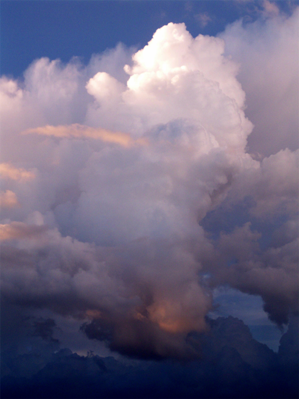
Major unknowns remain in understanding of cloud processes leading to the growth of cumulus clouds, specifically cumulus cloud updraft behaviors before and during convective initiation (CI), which is generally defined as the time when a cloud develops into a mature cumulonimbus cloud. Convective clouds are often challenging to simulate accurately in numerical weather prediction (NWP) models because of complex interactions between radiation, surface energy and moisture fluxes, and the growth of the planetary boundary layer (PBL). Ground-based ARM AMF3 observations are critical for observing the details of convective cloud updrafts, cloud base information, and PBL conditions maintaining the clouds, whereas high-resolution and frequent (1-5 minute) geostationary satellite observations are key to observing the evolution of cloud top characteristics. The proposed research will focus on cumulus clouds that evolve into other cumulus cloud types, and that may undergo CI, and how the land surface and lower-tropospheric conditions impact these processes.
Key science questions the project seeks to answer are: (1) How do ARM-observed cumulus cloud features, dynamics, and surface fluxes relate to satellite-observed cloud-top characteristics, how these relationships vary during transitions between cumulus cloud types, and how these are associated with CI success or failure, and (2) How does spatial heterogeneity at the land surface influence cloud growth surrounding the AMF3 station, and how can that information be used to guide ARM development efforts in Alabama? In order to answer these questions, the research focus will be on days characterized by humid boundary layers dominated by cumulus clouds either with or without developing convective storms during the 2023-2025 warm seasons. The focus will be on conducting pilot studies using AMF3 surface and PBL observations and satellite cloud property retrievals to provide new insight into the evolution of cumulus clouds before, during, and after CI, as a function of PBL structure and land surface conditions. The project’s main goal is to increase understanding on how ground-based observations can augment information provided by geostationary satellites, which together can be used to inform and improve the accuracy of NWP models. The ARM AMF3 datasets will be collected along with simultaneous 1-5 min resolution cumulus cloud datasets from the Advanced Baseline Imager on GOES-16/-18.
The project has the following expected outcomes: Seek to uncover and discern macrophysical cumulus cloud properties from combined ground- and satellite- observations, and how the science community can gain more information on convective clouds and CI from satellite-based fields compared to what is presently known; examine how conditions in the lower troposphere affect transitions in cloud type, cloud growth rates, and the longevity of cumulus clouds leading either to CI success or failure; and, assess sensitivities of the land surface model and PBL parameterization schemes to the observed cloud fields for CI and non-CI events.
(2) Machine learning to improve planetary boundary layer profile development over oceans, and in studies related to the 0-4 hour nowcasting of convective storms
Active research is occurring in the areas of machine learning as applied to various problems in atmospheric science. My research in this subject area is focused on two specific problems:
a) To improve the retrieval of high-vertical resolution atmospheric profiled of temperature and moisture in the atmospheric boundary layer (ABL) over oceans. An AI modeling framework is developed to perform data fusion of single-source satellite temperature and water vapor retrievals from infrared and microwave sources, non-satellite numerical weather prediction (NWP) profiles from a short-term (6-12 hour) NWP model forecast (those which are not used as part of current IR and MW satellite retrieval algorithms), satellite-derived sea surface temperature and wind measurements, and radiosonde “truth” profiles. The project out come will be temperature and water vapor profiles of the marine atmospheric boundary layer (ABL) at 100 m vertical resolution to better define inversions, as well as other ABL features. Also, a goal will be to determine what satellite-based profiles contribute the most toward representing the temperature and water vapor profile structure of the marine ABL (when compared to radiosondes).
b) For 0-4 hour convective initiation and storm intensity nowcasting. Despite extensive previous research on nowcasting convective storm initiation (CI) the key factors involved in the CI process are not well understood, making for the 0-6 hour forecasting of CI very challenging on space and time scales of interest for societal needs (10’s of km, 30 min). CI is defined as a ≥35 dBZ intensity radar echo at the surface or at the –10° C level. Forecasting of thunderstorms in such short timeframes by numerical weather prediction models often suffers due to model “spin-up,” forcing a heavy reliance on extrapolation of real-time observations. However, the 2-6 h timeframe is beyond when extrapolation techniques typically work well for predicting thunderstorm development. Previous studies have indicated that the CI process is a combined interaction of the mesoscale and synoptic scale settings, mesoscale processes, as well as land-surface processes and orography that dictate boundary layer formation and local convergent circulations and moisture distributions. A focus is to develop a probabilistic 1-4 h CI nowcast product using machine-learning approaches operating on real-time observations that describe the initial/background conditions within the pre-thunderstorm environment. For this effort, there will be a heavy reliance on data from NASA and NOAA satellite remote sensing fields including sea and lake/river surface temperatures, cloud products (optical depth, effective radius), land use, elevation, topography, derived fields like Normalized Difference Vegetation Index, Leaf Area Index, 0-1 hour convective initiation nowcasts, and within established algorithms that retrieve sensible heating, evapotranspiration and soil moisture. Locations of CI will be determined from Weather Surveillance Radar–1988 Doppler (WSR-88D) reflectivity observations. All NOAA and NASA data and other fields will be formed into a training database of many 1000’s of CI events to be operated on by machine learning statistical methods after association rules are formed outward of high-resolution (~200 m) simulations are performed.
(3) Microphysical analysis of above anvil cirrus plumes within convective storms, and as related to severe weather
Above anvil cirrus plumes (AACPs) form atop deep active convective storm anvils and are documented to be associated with surface severe weather (large hail, strong winds and tornadoes). The microphysical of AACP clouds are composed of smaller ice particles that increase their reflectance in shortwave infrared (SWIR) satellite imagery, as they form in the lower stratosphere. Research is ongoing to determine which SWIR channels exhibit the strongest signatures over AACP lifetimes, determine the influence of solar zenith angle (SZA) on AACP reflectances, and assess how several GridRad radar-derived fields known to be associated with severe weather relate to AACP presence. Hundreds of AACPs, along with overshooting tops and other updraft regions atop deep convective storms, were labeled and analyzed using 1 min GOES-16/-17 Advanced Baseline Imager observations in 2019-2021. The channels of interest are 0.64, 1.37, 1.6, 2.24, 3.9 µm reflectances, and 10.35 µm brightness temperatures. Results show: (a) AACPs are most prevalent in the 0.64, 1.6 and 3.9 µm channel reflectance data, (b) AACPs are most visibly distinct from the background cloud anvil regions at SZAs from 40°-60°, which often the time of day in the U.S. when they are most mature, (c) AACPs possess a strong 1.37 µm water vapor absorption signature relative to non-plume cloud anvil regions, and (d) GridRad radar 10- and 40-dBZ echo heights and column maximum reflectivity show that AACPs begin 10s of minutes before the maximum altitudes field are observed, as indicative of severe storms with large sustained updrafts.
(4) GOES solar insolation estimation for evapotranspiration modeling
Thermal infrared remote sensing of land-surface temperature provides valuable information about the sub-surface moisture status required for estimating evapotranspiration (ET) and detecting the onset and severity of drought. A desire for maps of ET in Florida that are spatially continuous and computed with consistent methodology was a primary motivation for the research. ET can be estimated on regional scales at high spatial resolution (~1 km) using 0.5 km resolution geostationary (GOES, currently GOES-16) satellite solar radiation data, as solar radiation is a primary driver of net radiation and ultimately ET. Net radiation is derived from incoming solar radiation using estimates of land-surface albedo. GOES solar radiation data from 1 January 1985 to 31 December 2022 have been produced. As of 2017, an updated solar insolation algorithm model is being used for this research, which includes improvements for small biases related to cloud cover in higher elevations, as well as improves atmospheric corrections for regions where thin clouds and aerosols are present, and for satellite-derived total precipitable water. Research continues as the GOES-16 derived solar insolation datasets are used to form ET for a wide variety of water resource management applications.
(5) Estimation of convective cloud and storm updraft magnitudes using GOES-16 observations using satellite derived products and lightning data.
Prior research in convective storm cloud analysis has demonstrated how cloud-top cooling rates (CTCR), overshooting cloud tops (OT), and derived cloud top divergence (CTD) retrieve or infer various components of in-cloud updrafts for actively growing cumulus clouds and mature deep convective storms. One research focus area is on how CTCR, OT and CDT algorithms that presently run individually in real-time, can be used together to understand in-cloud updraft patterns. Although the CTCR, OT and CTD products provide or infer convective updraft information separately, research is occurring that combines information from the three methods, and through product fusion, would produce an updraft-focused product that both increases confidence in updraft presence, and better quantify updraft locations, structures and strengths. In addition to the geostationary satellite-based fields, comparisons to theoretical convective available potential energy (CAPE) estimates of updraft magnitude, as well as to 100-250 meter resolution cloud-resolving model simulations, will be made as a means of validating and improving such a new algorithm. |